Skip to content

Generator of Blast Flyrock Modelling & Safety Exclusion Zone Based on a 3D ballistic dome, for blasting in open-pit mines, quarries and civil engineering worksites

Precise calculation. One interface. One software, from contour to plan. From blast geometry to perimeters, without complications.

Request a demo See the features
DEFINITION

What BlastClear does

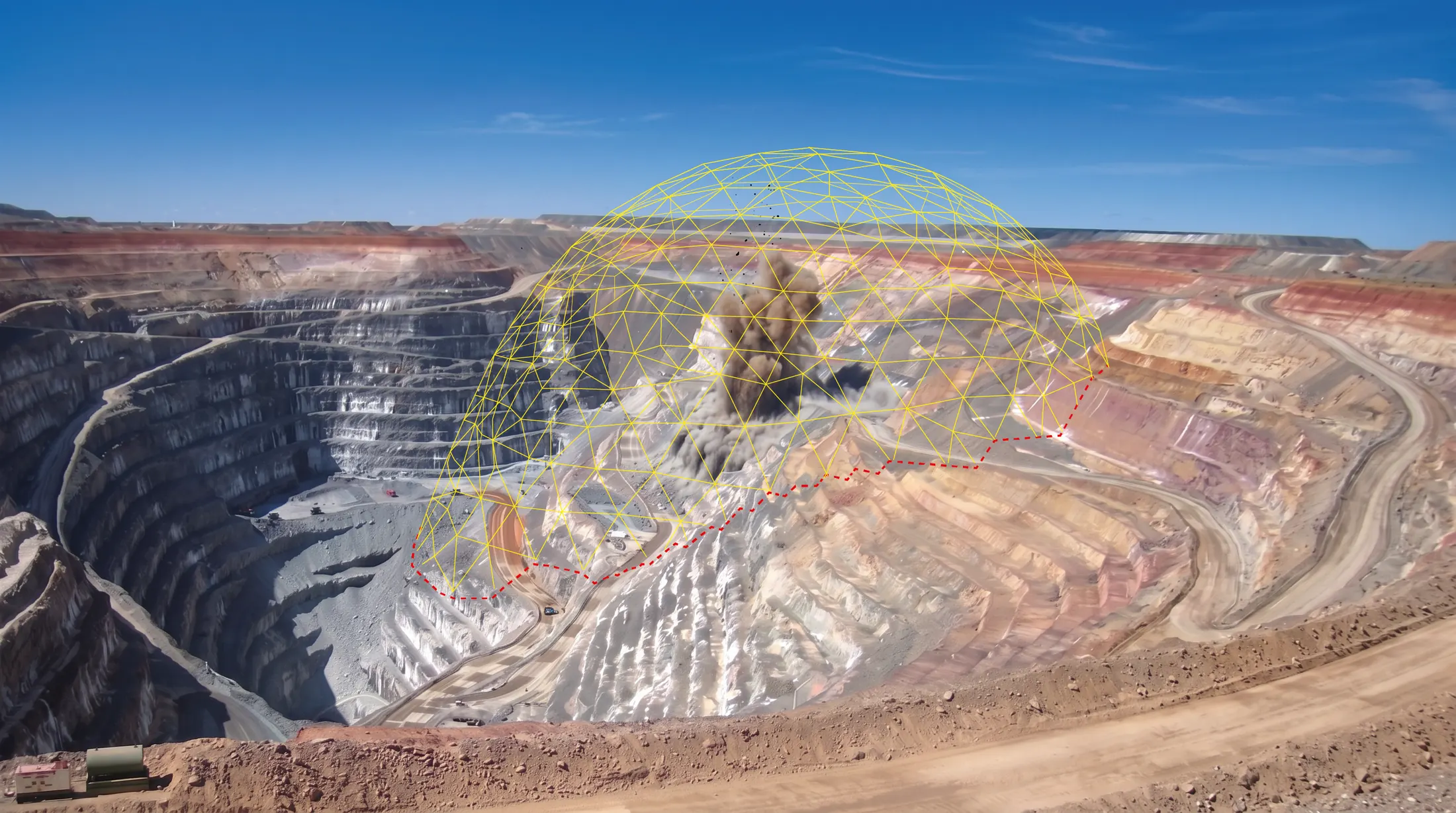
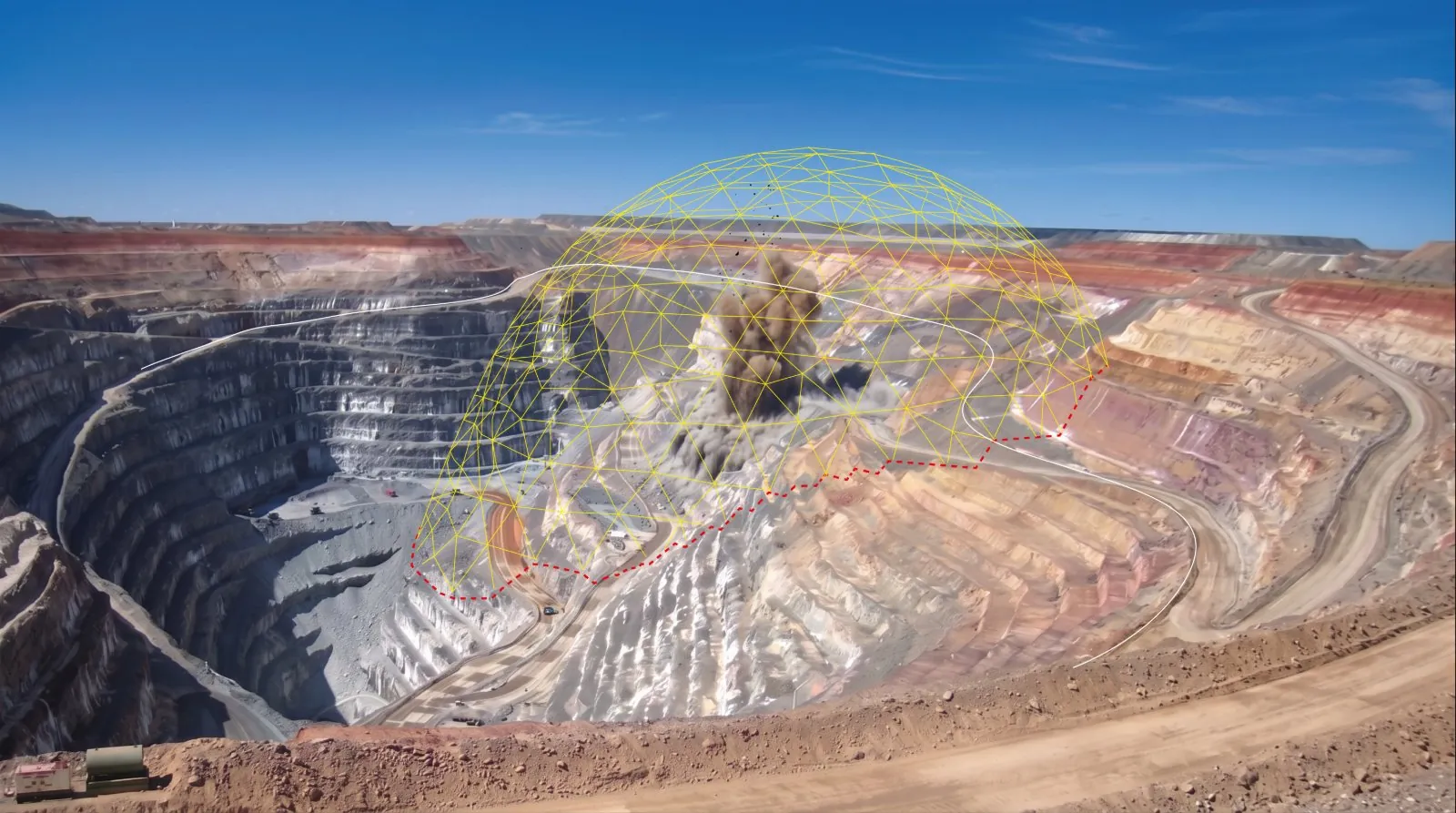
BlastClear builds the safety exclusion zone of a blast from the ballistic dome matching the maximum radius you set. The reach is then graded sector by sector around the blast: full to the front, where the flyrock goes, reduced laterally, reduced further to the rear.

The dome is intersected with the actual site topography. The perimeter therefore follows the ground, its benches and its breaks of slope, rather than a theoretical horizontal plane.

All three families of blast are handled in the same project: production on a closed contour, pre-splitting on polylines, boulder blasting on points. Several blasts of the same round merge into a single perimeter, with no manual rework. The result comes out as a PDF drawing ready to sign, as DXF for the site drawings, or as an image.

Read more
BEFORE

Topography in one tool, contours in another. The perimeter stays a circle: no 3D dome ; and when there is one, the topography intersections and the merging of perimeters are still handled by hand, then the plan is redrawn. Four tools, half a day, and a clearance zone that remains an estimate built on centroids and offsets.

WITH BLASTCLEAR

Import the contour and the topography, get a 3D dome computed on the real blast geometry, reduction sectors applied and a signed PDF plan ready to circulate. One interface, a few minutes.

THE SOFTWARE
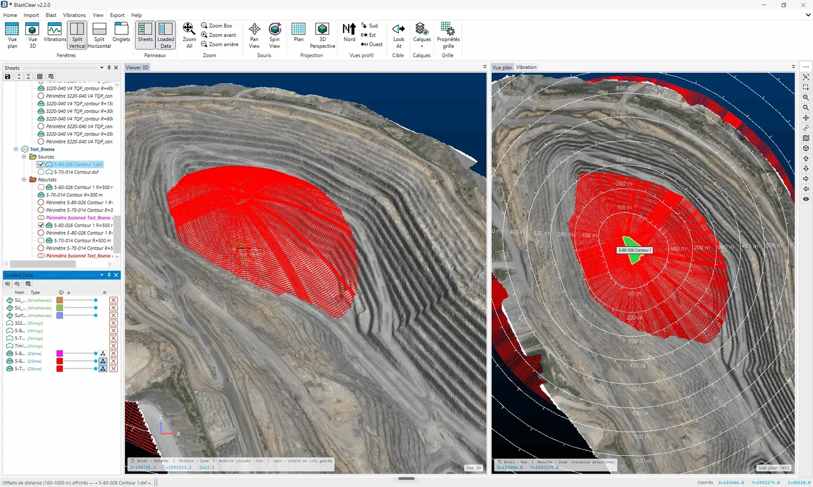
  • Pit and blast outlines imported from DXF
    Pit and blast outlines imported from DXF

  • Exclusion dome computed on the real topography

    Exclusion dome computed on the real topography

DOME OR CIRCLE

Why not simply a circle

A circle applies the same distance in every direction, over ground that never is flat. On this deep blast, at the same 500 m radius, it covers 78 hectares where the dome intersected with the topography holds 36. It ties up twice the ground, and still falls short of the dome where the terrain drops away.

Features

DOME COMPUTATION

  • Domes matched to the real blast contour (DXF), not generic circles
  • Reduction sectors: e.g. rear −30 %, lateral −15 %, front not reduced
  • Automatic intersection with drone topography (GeoTIFF texture supported)
  • Blast orientation detected from the initiation timing
  • Built-in radius simulator

ALL BLAST TYPES

  • Production: complex contours
  • Pre-splitting: polylines
  • Boulder blasting: points
  • Multi-blast merge with no manual rework
  • Batch processing: several radii for several blasts in one pass
  • Forward-looking simulations for pits under study

IMPORTS & DELIVERABLES

  • Open import (DXF, CSV)
  • Site infrastructure import in DXF
  • PDF plans: customisable title block, automatic dimensions and north arrow
  • Built-in safety pictograms
  • 300 dpi PNG images, transparent or solid background
  • DXF export

Estimated gains

+ 200 h
of working time saved per year
6-7 months
return on investment
340+
blasts validated in production
−15 %
fewer equipment movements

Estimates based on one open-pit operation. Actual gains depend on site context.

Request a demo
Request a demo